
By Henry Empeño | August 31, 2026
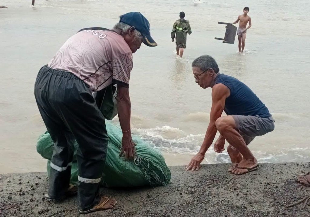
SAN MARCELINO, Zambales — Residents of lahar-stricken villages in San Marcelino, Zambales began moving to higher ground on Sunday, August 30, as a precaution against expected lahar flow even as local authorities hastened to shore up segments of river dikes that gave way amid continuous heavy rains from the enhanced southwest monsoon or habagat.
San Marcelino Mayor Elvis Soria gave the order for preemptive evacuation at Barangay Sta. Fe following an advisory from the Department of Science and Technology-Philippine Institute of Volcanology and Seismology (DOST-Phivolcs) of impending volcanic sediment flows, muddy stream flows, or muddy run-off in rivers and drainage areas.
DOST-Phivolcs said on Saturday, August 29, that prolonged and intense rainfall may generate non-eruption lahars on major rivers draining the western flank of Mount Pinatubo “where significant deposits of the 1991 PDCs (pyroclastic density current) remain on the watershed.”
It added that Pinatubo lahars would likely occur on the upper to middle reaches of the Sto. Tomas-Marella and Bucao River systems in Zambales.
“(These) may transition to muddy stream flows and floods on the lower reaches and affect adjacent communities of San Marcelino, San Narciso, San Felipe, and Botolan,” DOST-Phivolcs warned.
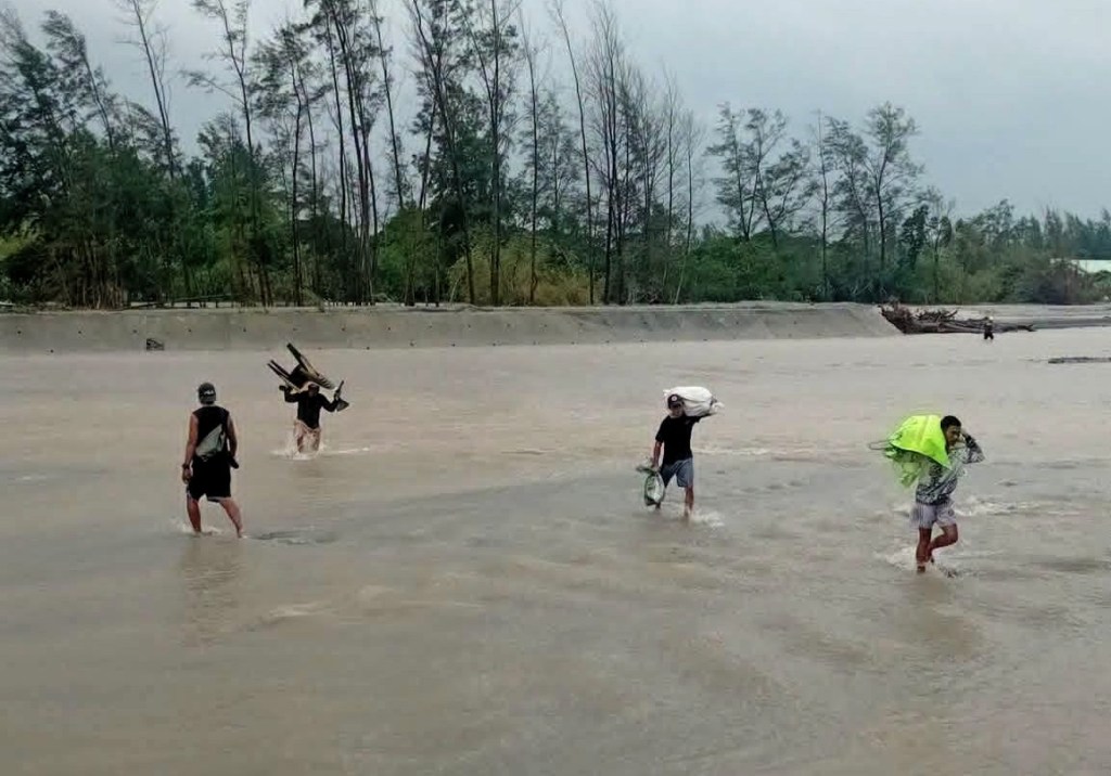
Sta. Fe, which lies along the lahar field of the Sto. Tomas-Marella River, has been cut off from the rest of the municipality after the lahar-filled river swept away the bridge leading to the barangay, swamped the village with mud and sand, and flooded houses, schools, and other public facilities.
Eighteen families in Barangay Aglao southeast of Sta. Fe have also pre-emptively evacuated as early as Friday, August 28, as the Sto. Tomas-Marella River swelled.
The San Marcelino Municipal Disaster Risk Reduction and Management Office (MDRRMO) said on Monday, August 31, that the river dike protecting the north side of Sta. Fe has been breached by strong river current, while the Vega-Lawin Dike in nearby Barangay San Rafael has developed a crack.
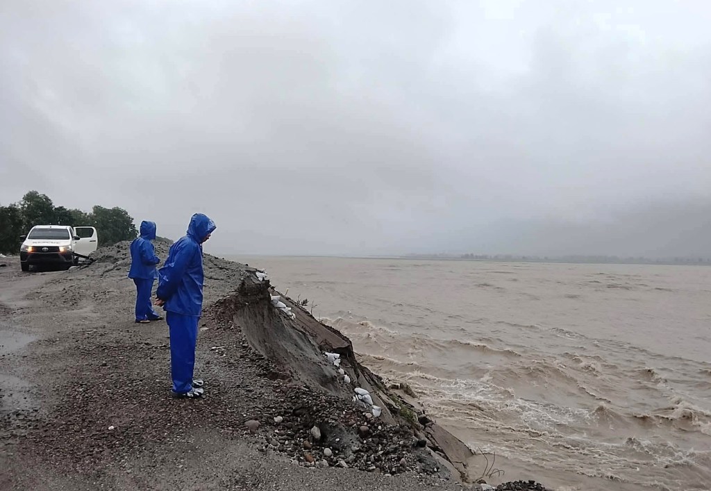
Soria said on Saturday that the Vega-Lawin Dike remained structurally sound, but nonetheless ordered the construction of a spur dike near the breach to strengthen the dike foundation.
Elsewhere in the province, six other dikes have been damaged following heavy rains from the three successive typhoons that battered Zambales: Luis, Maymay, and Neneng, according to the Provincial Disaster Risk Reduction and Management Office (PDRRMO).
These are the Bucao River and Bancal River dikes in Botolan town, Tapuac River dike in Masinloc, and Tanguay dike, Kiling River dike, and Dalayap Creek dike in Cabangan.
The Bucao River Dike, in particular, sustained breaches in seven sections, with total damages estimated at P375.3 million, said PDRRMO head Rolex Estella.
Four river revetment projects in the towns of Subic and San Marcelino were also destroyed, with total damages of P96.85 million.
Estella said local government units are closely monitoring the situation in riverine communities along three lahar-filled rivers: the Sto. Tomas-Marella River which runs through the towns of San Marcelino, San Narciso, and San Felipe; Bucao River in Botolan; and the Maloma River in San Felipe.
Governor Hermogenes Ebdane Jr. said earlier that lahar from the 1991 volcanic eruption continues to be a major threat to Zambales communities during the rainy season when heavy downpour dislodges massive deposits upstream and send them cascading downriver.
The Mines and Geosciences Bureau estimated that 6.7 billion cubic meters of volcanic debris remain on the Zambales side of Pinatubo, with 3 billion cubic meters, or 63.8 percent of river-bound lahar, in the Bucao River basin, and 1.6 billion cubic meters in the Sto. Tomas River basin.
Zambales was placed under a state of calamity on August 19 after sustaining more than P591.98 million in damages to agriculture and infrastructure from the combined effects of habagat and tropical cyclones. ▲



 Headline Zambales
Leave a comment