
By HENRY EMPEÑO | October 4, 2025
MASINLOC, Zambales — Seaside communities and villages located along riverbanks suffered the worst flooding in Zambales, as heavy rains from Typhoon “Paolo” and a rising tide combined to inundate most parts of Zambales on Friday, October 3.
Rolex Estella, head of the Zambales Provincial Disaster Risk Reduction and Management Office (PDRRMO) said on Saturday, October 4, that the high tide phenomenon peaking at about 5:00 a.m. on October 3 compounded the effects of the typhoon.
This is why severe flooding was observed in areas near major rivers and waterways across the province, especially in the towns of San Antonio, San Felipe, Botolan, Masinloc, and Santa Cruz, he added.
“Zambales was placed under Orange rainfall warning at 11 a.m. and then under Red warning at 2:30 p.m. on last Friday,” Estella noted. “Heavy rainfall, especially in the mountains, resulted in a large volume of water going downriver, thereby causing waterways to overflow and flood low-lying areas,” he added.
Estella explained that an Orange rainfall advisory meant that from 15 to 30 millimeters of rain is expected within the hour, and that flooding is imminent in low-lying areas and near river channels. A Red warning, meanwhile, meant more than 30 millimeters of rainfall and severe flooding is expected. The advisories are issued to the public through social media and local DRMMO offices, he said.
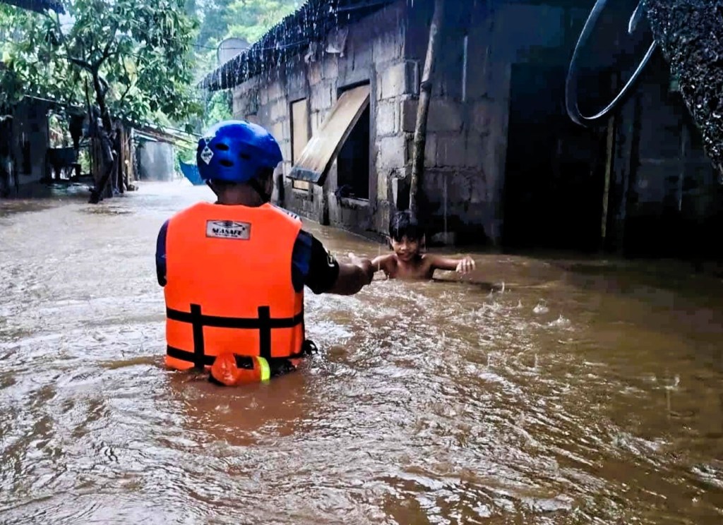
The PDRRMO said a total of 893 families, composed of 2,373 individuals, fled their homes from 11 of the 13 towns of Zambales at the height of Typhoon Paolo.
Most of the evacuees are from the northern towns of Santa Cruz, with 303 families, or 694 individuals; Masinloc, with 250 families, or 565 individuals; and Botolan, with 125 families, or 402 individuals.
While initial reports placed severe flooding along sections of the highway in central Zambales, notably San Felipe, Cabangan, and Botolan, coastal and riverine communities up north were the most vulnerable to flooding, PDRRMO data showed.
At Barangay Tapuac in Masinloc, floodwaters rose to waist-deep when the nearby Hamat River overflowed its banks, forcing 33 families to seek shelter at the Tapuac Elementary School.
A creek running along Barangay San Lorenzo, also in Masinloc, likewise overflowed during high tide, making the highway impassable to light vehicles last Friday, said Malou Anoche, who operates a carinderia in the area.
Anoche said that portion of the highway has become flooded during heavy rains in the last three years. The area used to be a swamp of mangroves, but has been converted into fishponds in the 70’s.
Estella, meanwhile, observed that silted waterways directly worsened flooding in Zambales. He said that municipal DRRMO units have been instructed to clear clogged waterways with the help of local officials and volunteer groups.
